


Fieldon Twp. Voting District, Watonwan County, Minnesota
About
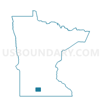
Outline

Summary
| Unique Area Identifier | 604858 |
| Name | Fieldon Twp. Voting District |
| County | Watonwan County |
| State | Minnesota |
| Area (square miles) | 35.88 |
| Land Area (square miles) | 35.74 |
| Water Area (square miles) | 0.14 |
| % of Land Area | 99.61 |
| % of Water Area | 0.39 |
| Latitude of the Internal Point | 43.98653430 |
| Longtitude of the Internal Point | -94.42148830 |
Maps


Graphs
Select a template below for downloading or customizing gragh for Fieldon Twp. Voting District, Watonwan County, Minnesota


Neighbors
Neighoring Voting District (by Name) Neighboring Voting District on the Map
- Antrim Twp. Voting District, Watonwan County, MN
- Ceresco Twp. Voting District, Blue Earth County, MN
- Lincoln Twp. Voting District, Blue Earth County, MN
- Madelia Twp. Voting District, Watonwan County, MN
- Pleasant Mound Twp. Voting District, Blue Earth County, MN
- Riverdale Twp. Voting District, Watonwan County, MN
- Rosendale Twp. Voting District, Watonwan County, MN
- South Branch Twp. Voting District, Watonwan County, MN
Top 10 Neighboring County Subdivision (by Population) Neighboring County Subdivision on the Map
- Madelia township, Watonwan County, MN (351)
- Rosendale township, Watonwan County, MN (300)
- Riverdale township, Watonwan County, MN (294)
- South Branch township, Watonwan County, MN (282)
- Antrim township, Watonwan County, MN (240)
- Ceresco township, Blue Earth County, MN (239)
- Pleasant Mound township, Blue Earth County, MN (214)
- Fieldon township, Watonwan County, MN (209)
- Lincoln township, Blue Earth County, MN (200)
Top 10 Neighboring Unified School District (by Population) Neighboring Unified School District on the Map
- St. James Public School District, MN (6,620)
- Madelia Public School District, MN (3,395)
- Truman Public School District, MN (2,374)
Top 10 Neighboring State Legislative District Lower Chamber (by Population) Neighboring State Legislative District Lower Chamber on the Map
- State House District 24B, MN (36,327)
- State House District 21B, MN (35,392)
- State House District 24A, MN (34,825)
Top 10 Neighboring State Legislative District Upper Chamber (by Population) Neighboring State Legislative District Upper Chamber on the Map
Top 10 Neighboring 111th Congressional District (by Population) Neighboring 111th Congressional District on the Map
Top 10 Neighboring Census Tract (by Population) Neighboring Census Tract on the Map
- Census Tract 9501, Watonwan County, MN (3,568)
- Census Tract 1709, Blue Earth County, MN (3,152)
- Census Tract 9503, Watonwan County, MN (2,977)
- Census Tract 1715, Blue Earth County, MN (2,792)